Research
Glaciers flow and dynamics
Ice flow controls ice transport to lower elevation where it melts. It is a key component of the glacier-climate relationship and impacts glacier melt rates and extent. It is necessary to understand how glacier flow responds to changes in climate in order to estimate glaciers future evolution and contribution to water resources and sea level rise.
Since 2012, I have developed methodologies to observe ice flow from satellite repeat imagery at regional scales (see for example this article).
I have used these observations in different regions to try to understand the factor controlling ice flow and increase our understanding of glacier processes.
- In a study led by A. Tedstone, we showed that ice motion across an 8,000 km2 land-terminating region of the west Greenland Ice Sheet margin was 12% slower in 2007–14 compared with 1985– 94, despite a 50% increase in surface meltwater production. This is in opposition with previous studies suggesting an acceleration of the ice sheet in response to enhanced surface melting and shows that this sector of the ice-sheet is more resilient to surface melting than previously thought.
- In a study led by O. King, we examined changes in the velocity and surface elevation of lake- vs land-terminating glaciers in the Everest region, central Himalaya, over the time period 2000 to 2015. We showed that while all land-terminating glaciers slowed-down, lake-terminating glaciers had contrasted behaviours with some glaciers speeding-up and other slowing down, likely in relation with different lake expansions.
- In a recent study, I analyzed changes in ice flow velocity for all glacier in High Mountain Asia over the period 2000-2017 and showed that most glaciers are slowing down in response to a warming climate. I further demonstrated that the slowdown can be largely explained by the change in thickness implying that decadal and regional changes in ice flow are largely insensitive to changes in conditions at the bed of the glacier and can be well estimated from ice thickness change and slope alone.

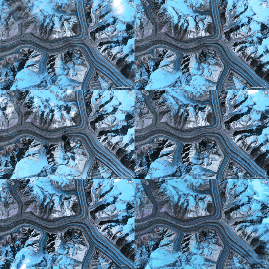
Time-lapse of Landsat satellite images (1991-2002) illustrating ice flow of the Baltoro glacier, Pakistan (Credit: NASA)
Glaciers contribution to sea level rise since the 1970s
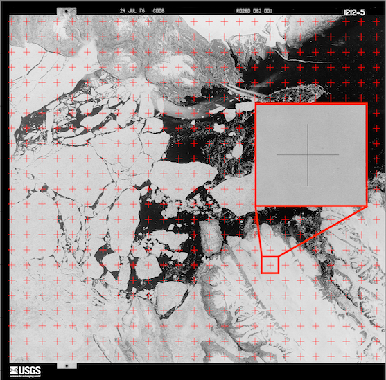
Glaciers contribution to sea-level rise is poorly constrained for the second half of the twentieth century. The aim of my current project is to exploit recently declasssified reconnaissance imagery (“spy” satellites) to reconstruct glaciers topography in the 1970s and 80s in order to estimate their volume changes over the last 4 decades in relationship with climate change.

Hexagon (KH-9) image over the Canadian arctic with fiducial markers highlighted in red

